By Ralph Jennings
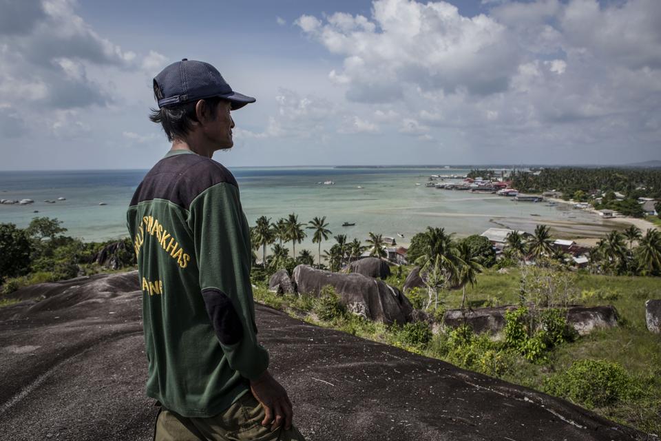
A man scans the coastline Aug. 20, 2016 in Natuna, Ranai, Indonesia. Most Natuna locals work as fishermen. Amid escalated tensions at the South China Sea, Indonesia continues to maintain its sovereignty over the Natuna Islands through security patrols along Indonesia's Exclusive Economic Zone.
China has been said to claim 95% of the South China Sea, running from its southern coast to the island of Borneo.
Vagueness as a bargaining tool?
The fuzziness of China’s line keeps other countries scratching their heads.
A man scans the coastline Aug. 20, 2016 in Natuna, Ranai, Indonesia. Most Natuna locals work as fishermen. Amid escalated tensions at the South China Sea, Indonesia continues to maintain its sovereignty over the Natuna Islands through security patrols along Indonesia's Exclusive Economic Zone.
China has been said to claim 95% of the South China Sea, running from its southern coast to the island of Borneo.
Reports say that around 90% of that South China Sea falls under Beijing’s purview, while others place the percentage closer to 80.
So how much of the 3.5 million-square-kilometer sea does China actually claim, earning the title as the most aggressive among six governments that vie for sovereignty over the same waters?
The short answer – no one knows because China has never announced a clear demarcation line and may actually want to keep it vague.
“All of this is intentional on China's part,” says Greg Poling, director of the Asia Maritime Transparency Initiative under American think tank Center for Strategic and International Studies.
“It isn't going to clarify the position of the line because it has no legal rationale yet for what it means.”
What’s clear is that China claims more than anyone else along the sea, which is known for its fisheries, natural gas and shipping lanes.
What’s clear is that China claims more than anyone else along the sea, which is known for its fisheries, natural gas and shipping lanes.
Since 2010 it has irked others by building artificial islets for military use.
The South China Sea dispute is expected to surface in mid-November when Chinese officials meet counterparts from 10 Southeast Asian countries including those with competing maritime claims.
The nine-dash line
China formally uses a nine-dash line, which originated with its former Nationalist government in 1947 and has been re-plotted over the years by numerous analysts trying to understand the lay of the sea better. (The American think tank offers this version.)
Even China reinterprets it periodically.
In 2015, Foreign Minister Wang Yi said that line should not be the “focus” of the South China Sea issue, rather who occupies which islets, Beijing’s official Xinhua News Agency reported then.
The dashes show Beijing taking in sea tracts extending down the coast of Vietnam over to Malaysian Borneo and neighboring Brunei, then up the Philippine west coasts toward Taiwan.
The dashes show Beijing taking in sea tracts extending down the coast of Vietnam over to Malaysian Borneo and neighboring Brunei, then up the Philippine west coasts toward Taiwan.
The other parties mentioned here all claim parts of what China says belongs under its flag.
But the dashes are 20-kilometers thick according to a Chinese map updated in 2009 for the U.N. Commission on the Limits of the Continental Shelf, Poling says.
Exactness is naturally difficult.
There’s also no telling how the dashes are connected, analysts argue.
The gaps between them are just blue waters on Chinese maps.

The Chinese nine-dash line in the South China Sea
“On the demarcation of nine-dash line, I am rather certain there is none,” says Yun Sun, East Asia Program senior associate at the Stimson Center think tank in Washington.
The Chinese nine-dash line in the South China Sea
“On the demarcation of nine-dash line, I am rather certain there is none,” says Yun Sun, East Asia Program senior associate at the Stimson Center think tank in Washington.
“The line was drawn on the map artificially and randomly by the (Nationalist) government, with no clear mapping or demarcation done beforehand. The dash line, rather than a solid line, signifies the ambiguous and different status of the areas between the dashes and the line itself.”
Other countries base their claims on thinner, connected lines that delineate exclusive economic zones extending 370 kilometers offshore, or on continental shelves.
Other countries base their claims on thinner, connected lines that delineate exclusive economic zones extending 370 kilometers offshore, or on continental shelves.
Malaysia, for example, marks its claim in zigs and zags that encompass the islets it considers its own.
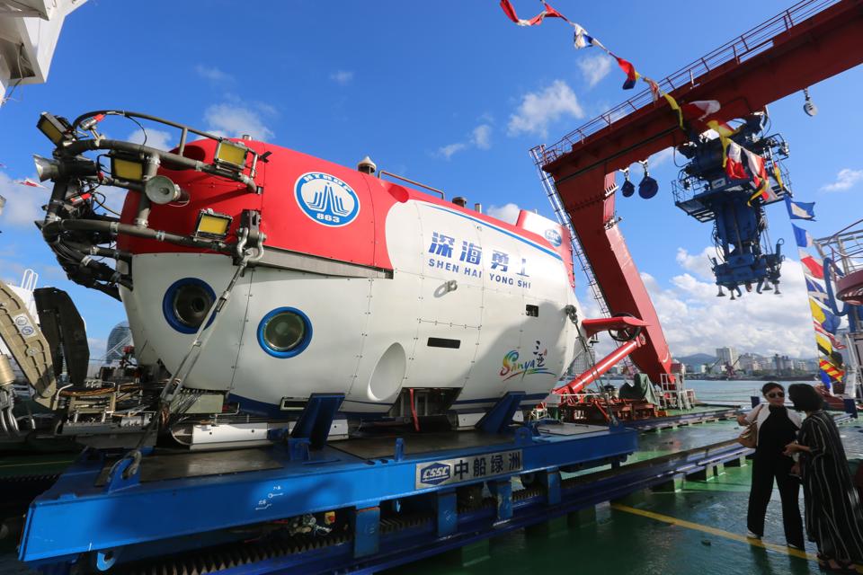
China's manned submersible Shenhai Yongshi (or Deep-sea Warrior), on board the exploration ship Tansuo-1, returns to port after completing the deep-sea testing on Oct. 3, 2017 in Sanya, Hainan Province of China.
China's manned submersible Shenhai Yongshi (or Deep-sea Warrior), on board the exploration ship Tansuo-1, returns to port after completing the deep-sea testing on Oct. 3, 2017 in Sanya, Hainan Province of China.
Vagueness as a bargaining tool?
The fuzziness of China’s line keeps other countries scratching their heads.
It has vexed Indonesia, for example, as the giant archipelago’s government steps up enforcement of fisheries near its outlying Natuna Islands, says Collin Koh, maritime security research fellow at Nanyang Technological University in Singapore.
Enforcement against Chinese vessels increased after 2012 around the Natuna chain as it lies near the southern end of China’s nine dashes.
“What I understood, based on what Indonesian officials said publicly, is that they don’t recognize a dispute with China exists because there’s simply no geographical coordinates or datum that can accurately pinpoint those lines,” Koh says.
That's the whole idea, analysts believe.
“What I understood, based on what Indonesian officials said publicly, is that they don’t recognize a dispute with China exists because there’s simply no geographical coordinates or datum that can accurately pinpoint those lines,” Koh says.
That's the whole idea, analysts believe.
China has marked a line clearly enough that other maritime states must pay attention but vaguely enough that they can negotiate as needed over actual control.
"It leaves room for negotiation,” Sun says.
"It leaves room for negotiation,” Sun says.
“The question then will be, if the status is unsettled, how could China drill oil there? That is how the Chinese push the other claimants back to bilateral negotiations. You don’t want us to drill? Why don’t we sit down and talk about it. You don’t talk to us, we'll do whatever we want."
Aucun commentaire:
Enregistrer un commentaire